Travel Route 66:
15 day self-guided motorcycle tour!
Optional departure to Harley-Davidson Headquarters + museum visit $85 pp
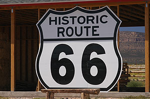
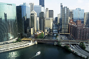
Day 1: Arrive to Chicago, IL
After touching down at Chicago International Airport we ask you to transfer to your hotel. Chicago, it almost goes out with saying, is one hell of a town; the largest, most vibrant of the Great Lake cities. The city skyline has few peers and down on the streets you’ll find a fantastic selection of world class museums, restaurants and cafes. There is also the city’s famed bar and nightclub scene that is still anchored in an incredible jazz and blues tradition. In the morning the long dreamt of journey across Route 66 begins.
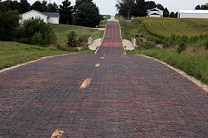
Day 2: Chicago, IL - Springfield, IL (Miles:187, Kilometers:301)
First order of business is to pick up your Harley-Davidson before you can start on the ultimate American road trip. Parallel to I-55, (the Interstate 55) the legendary Route 66 began its run right here. It cut through the state before it ran the whole way to the Pacific Coast. Along the way you’ll see old-time diners and service stations which are a real slice of Americana. Riding South from Chicago, we will pass the old archetypal truck stop town of McLean, but we don’t linger, instead we barrel through the coal-mining area of Illinois and continue along the Pontiac Trail, as this road used to be known. Your hotel is just a stone’s throw from the site of Abraham Lincoln's Illinois home.
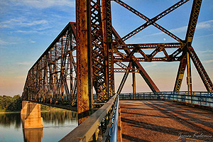
Day 3: Springfield, IL - Rolla, MO (Miles:205, Kilometers:328)
Making your way south, you head towards the state of Missouri on your way to St. Louis, a town rich in history. Along the way, you will pass through a number of Highway towns, which are great places for a stop en route. One thing’s for sure, you should see the famous Dixie truck stop, "Our Lady of the Highway Statue", Litchfield and the "Ariston Café". You will also set aside some time to visit Meramec Caverns as you head for the Mississippi River – a complex of mineral formations which are as rare as they are exquisite. And of course you couldn’t miss the famous "Chain of Rocks Bridge" - at least from a distance as it is now closed to motor traffic. Now you are properly in Missouri, the state where the Mississippi River meets the Missouri River, and where you can find both forests meet the grassland prairies. It’s a short ride from the state border into the "Gateway to the West," St. Louis, a dynamic and cultured city nestled along the shores of the almighty Mississippi River. Soon after you will have St. Louis in your rear view mirrors as you leave the city for the rolling Missouri hills. You will soon see why this is such a popular stretch for riders.
Day 4: Rolla, MO - Tulsa OK (Miles:290, Kilometers:464)
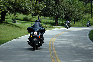
You visit "Gay Parita Service Station" just West of Springfield MO. This is a must stop in a wonderful world of Route 66 attractions. You could easily spend hours just going through all the treasures there.
Welcome to Kansas! Kansas has got the shortest stretch of Route 66 asphalt: only 13 beautiful miles. In Galena there is a chance you meet "Tow Mater" from the movie CARS – the original 1951 International boom truck next to the old garage on the old Route 66.
On your way to Baxter Springs, Kansas and just few miles west of Riverton we come to the Marsh Arch "Rainbow Bridge" on the old alignment of Route 66. This is one elegant old bridge, though it is far smaller than the old Spring River Bridge, which did not survive the "new is better" ethos so evident during the 1970s and 80s.
However, not on Route 66 but with a little detour you can visit the Totem Pole Park (listed on the National Register of Historic Places) - home to the World’s Largest Concrete Totem Pole, a 90 foot totem pole that towers over the park in an astonishing array of folk art colors, with the four nine-foot Indians near the top each representing a different tribe.
Between 1937 and 1948, one Ed Galloway built the totem pole utilizing some 28 tons of cement, six tons of steel, and 100 tons of sand and rock. Ed’s personal tribute to the American Indian features a collection of some 200 carved pictures.
Day 5: Tulsa, MO - Clinton, OK (Miles:195, Kilometers:312)
Seaba Filling Station: listed on the National Register of Historic Places, this Route 66 landmark is now filled with over 65 vintage motorcycles from 1908 to present. The Seaba Station was built in 1921, five years before historic Route 66 was certified as a national highway. Let you pay a visit to browse through motorcycle displays, antiques, souvenirs and more.
At Arcadia, Travelers frequently pause to consider the statue of Washington Irving, and all his works and deeds. Then there’s the iconic Round Barn, according to many the most photographed spot of all on Route 66. These days there is yet another reason to stop in Arcadia: POP'S, a somewhat futuristic looking restaurant on Route 66 that’s bound to become one of the many instantly recognizable landmarks on "America’s Main Street"!
The National Cowboy & Western Heritage Museum on Oklahoma City features a superb collection of classic and contemporary western art. The exhibition wing houses a turn-of-the-century town and interactive history galleries that focus on the American cowboy, rodeos, Native American culture, Victorian firearms, frontier military and western performers.
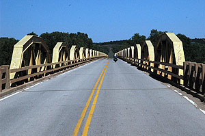
All in good fun, but you should continue your trip West reaching the interestingly named South Canadian River and the 38-arch bridge which traverses it. This bridge was indeed constructed using 38 low-rise truss arches, some 19 on each side. These arches are also known as "ponies": they are painted yellow and visible from some distance. It’s here you get the authentic feeling that comes from riding on a two-lane cement road which hugs the very contours of the earth, and rises and falls gently with the hills. Going down this road you get a sense of what it must’ve been like crossing Route 66 back in the 1930s ... except that you're almost certainly going much faster than they did back then!
The seams in the cement reverberate with a gentle rhythm on the ride up to the Oklahoma Route 66 Museum. Largely due to Jim Ross and Shellee Graham's many fine Route 66 photographs, probably this is the best out of the many museums on Route 66 (Clinton OK).
Day 6: Clinton, OK - Amarillo, TX (Miles:180, Kilometers:288)
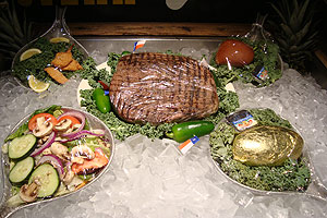
Get up nice and early for your trip into the Panhandle, the southernmost portion of the Great Plains. Frequently referred to as "the real Texas", the Panhandle really lives up to the popular stereotype of how Texas is supposed to look. Where the buffalo once roamed and the indigenous peoples once lived was considered perilous and uninhabitable frontier country. However its value went up sharply during the 1870s as a source of natural resources - specifically Helium, especially in Amarillo, and oil. Together with agriculture, this brought enormous wealth to the region. Although Amarillo can seem cut off, even from the rest of Texas, it sits on one of the great American cross-country routes – the I-40 (once a part of legendary Route 66), roughly 300 miles from Albuquerque and 250 miles west of Oklahoma City. Home to a few of the world’s largest cattle ranches, Amarillo takes its name from Spanish and means "yellow", the color so distinctive to this territory. Not only that but our good buddies from "The Big Texan Steakhouse" will pick everybody up at the hotel in a fleet of old Cadillacs with giant bull horns across the hood. On tonight’s menu are the finest steaks in the whole of Texas! Do not forget to arrange your complimentery limo ride from the hotel reception!
Day 7: Amarillo, TX - Santa Fe, NM (Miles:303, Kilometers:488)
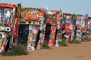
It’s time to bid a fond farewell to the Lone Star State. You are on your way to "The Land of Enchantment", that is New Mexico. After passing through the eccentric and colorful art installation known as Cadillac Ranch, you come to the highly atmospheric ghost town of Glen Rio, where you can stand with one foot in Texas and the other in New Mexico. At this stage of the trip, you have 5 states passed and 3 still ahead. The ride continues through the land of Comanche Indians and into Tucumcari, the largest town between Albuquerque and Amarillo. Then you head up into the High Plains and the slightly dizzying altitudes of Santa Fe in central New Mexico. Santa Fe is one of the oldest and most picturesque cities in the United States. It will be your base for the following two nights, in a hotel just steps from the historic town square and mission, in the heart of Santa Fe’s Old Town.
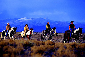
Day 8: Santa Fe, NM
You have the day at your leisure to rest and enjoy the distinct character of this nearly 400-year-old city. The mix of cultures in Santa Fe is evident in the Southwestern architectural style. In any case there’s no shortage of things to do in and around New Mexico’s capital city. Get up early and experience a hot air balloon trip at sunrise, be a cowboy for the day with a horseback ride on a mountain or canyon trail or take a ride along the river valley to Taos, an authentic Native American Indian ‘Pueblos’ or community.
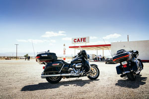
Day 9: Santa Fe, NM - Gallup, NM (Miles:200, Kilometers:320)
Heading south this morning you rode down to Albuquerque, New Mexico’s largest city. Home to a third of the state’s population, Albuquerque is a sprawling city situated at the crossroads of New Mexico, right at the spot where the main east - west road and rail routes cross both the old road south to Mexico and the fabled Rio Grande. Crossing this legendary waterway, you head west – all the way into the open country. Prepare to be overawed by the shapes and hues of this Navajo wilderness, with its steep cliff sides and table-top mesas. On into Laguna we ride - then through Grants and Cibola National Forest towards the quaint Route 66 town of Gallup. It’s an old railroad town - and a former Native American stronghold. Enjoy your stay in Gallup where it’s easy to strike up conversation with fellow riders from around the world at one of the town’s numerous biker-friendly hotels.
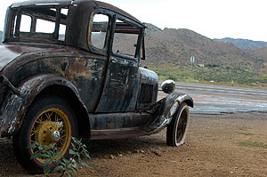
Day 10: Gallup, NM - Flagstaff, AZ (Miles:185, Kilometers:296)
From Gallup it’s a 30 minute ride to the Arizona border. You no sooner enter the state, before enjoying an awe-inspiring ride through the Petrified Forest. The multiple layers of colored terrain might remind you of an alien landscape but what you are looking at is actually a fossilized prehistoric forest of gigantic trees unearthed over the centuries by erosion. Just a little bit further west you will pass through Holbrook and Winslow – two old Route 66 towns whose livelihood is sustained by transcontinental truckers.
About six miles south of I-40 exit 233 and three miles east of the evocatively named Two Guns you arrive at Meteor Crater, another one of Arizona’s remarkable holes in the ground. It’s the result of an asteroid crashing to earth at a speed of 26,000 miles, some 50,000 years ago. Some 550 feet deep and almost a mile in diameter, these days the crater is actually a privately owned tourist attraction. Its "Astronauts Hall of Fame" plays up the crater’s likeness to the moon, not without justification when you learn that Apollo astronauts used to practice their moon-walk at Meteor Crater.
You ride on through the dense forestland southeast of Flagstaff, passing by the small seasonal stream of Walnut Creek, which over 1000s of years has engraved a 600 foot deep canyon into the local Kaibab limestone. As it flows east, it eventually joins with the Little Colorado River en route to the Grand Canyon. Over time, shallow caves were formed in the canyon walls. Way back in the 12th to 13th centuries the Sinagua Indians constructed many cave-dwellings high above the canyon floor, along the steep, easily defensible ledges.
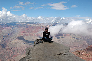
Day 11: Flagstaff, AZ - Williams, AZ (Miles:165, Kilometers:264)
The dream has become real right before your very eyes. If you don’t mind an early start, we can arrange a morning helicopter flight over the South Rim of the Grand Canyon. If you want to lie in just a little longer, that’s fine too. There will be ample time to ride along the rim, stopping to admire the spectacular vistas, and making the best out of photo opportunities. Then it’s finally time to leave the Grand Canyon and pick Route 66 back up in Williams, Arizona. Williams was the last Route 66 town that is bypassed the new highway system in 1984.
Day 12: Williams, AZ - Laughlin, NV (Miles:190, Kilometers:304)
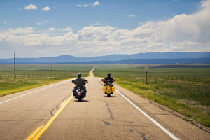
Route 66’s place in American history becomes the subject of ever more interest, Ash Fork’s place on the map seems assured. With all the stone quarries surrounding it, Ash Fork bills itself as "The Flagstone Capital of the World", It is also starting point for Crookton Road, which has the distinction of being one of the longest stretches of unbroken Route 66 highway in existence today.
Eventually you come to Seligman, which is a great little town, with clean streets and friendly people. There are, it has to be said, gift shops galore, most of them focused on Route 66 and American memorabilia, but there’s also a fine selection of biking clothing and accessories such as boots and leather jackets. Out on the street, there are vintage cars, colorfully dressed mannequins, and funny little street signs galore. As you’ll see, it’s a one of a kind.
Grand Canyon Caverns have been a must-see Route 66 tourist spot ever since the 1930s. A maze of limestone caves some 21 stories underground that wend their way all the way to the Grand Canyon, these caverns were formed over the course of 35 million years. You could fit 3 football fields inside the parts of the caverns where you can take a tour staring every 30 minutes.
On a smaller scale but interesting in its own way, is the old gas station at Hackberry. This former gas station and general store doesn't sell gas these days, but it does sell practically anything and everything associated with Old Route 66. Run by John and Kerry Pritchard, we recommend a walk behind the store, where they keep the really interesting memorabilia. That means old cars, sheds, garages, cactus, signs and more than we can list here. You can even take a carrot or two and feed the mules beyond the water garden.
Then if you like root beer, may we recommend Mr. D’z Kingman Route 66 Diner, proudly serving the finest root beer in the world. Root beer is in fact a kind of soda.
Tonight you kick back in Laughlin which is situated along the Colorado River, and adjacent to the best steakhouse West of Texas!
Day 13: Laughlin, NV - Victorville, CA (Miles:215, Kilometers:344)
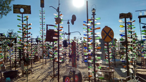
You are on your way to the sunshine state of California, the final state on your journey across the famed Route 66. We traverse the dunes and salt flats of the so-called Devil’s Playground. Indeed the Mojave Desert offers some of the most striking scenery in Southern California - or anywhere for that matter. Think dramatic volcanic formations, rolling grasslands, clusters of Joshua trees, and even in some spots, Pinion pine trees. Leaving the desert for dust, your ride takes you into the cooling forestlands of the San Gabriel Mountains. The final stop today is the former air force base town of Victorville, where you will spend the night.
Day 14: Victorville, CA - Los Angeles, CA (Miles:124, Kilometers:200)
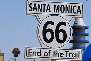
It will be with a mixture of emotions that you set out for the final destination of your legendary American road trip – Los Angeles. You make directly for Santa Monica, for the very good reason that Historic Route 66 actually comes to an end on Santa Monica Boulevard. When you see the "End of the Trail" sign on Santa Monica Pier, you’re bound to feel a sense of accomplishment, having finally made a dream come true, but also some sadness that the ride has finally ended. Of all LA’s resorts, Santa Monica is the largest and the oldest. Back in the flower-power days it was a hedonistic beachfront playground. It is still a liberal kind of place, but a lot more health-conscious these days. Now you have the afternoon free for sightseeing and can take in Beverly Hills, Rodeo Drive, the famous Chinese Theatre, and so much more besides.
Day 15: Los Angeles, CA
This journey of a lifetime comes to its end today in Los Angeles, unless of course you would like an extra night or two in L.A. – in which case let us know. We can even arrange a discounted motorcycle rental!
Rates for Standard Self-guide Tours (per person):
Various discounts may apply (season, group booking, early-bird, last-minute etc - please always contact us for your special rate)
1 rider 1 motorcycle 1 room from: US$5,550.00 (£4,052.00, AU$8,492.00, NZ$9,213.00, 4.718,00 €)
2 people 1 motorcycle 1 room, per person from: US$2,930.00 (£2,139.00, AU$4,483.00, NZ$4,864.00, 2.490,00 €)
2 people 2 motorcycles 1 room, per person from: US$4,350.00 (£3,176.00, AU$6,656.00, NZ$7,221.00, 3.698,00 €)
Using your own motorcycle on this tour: ask for your hotel only price (price is depending on season).
Using your own car on this tour: ask for your hotel only price (price is depending on season).
What's included in self-guide tours?
- All hotel accommodations
- Late model motorcycle rental
- Unlimited mileage
- Helmets for driver and passenger
- All taxes, fees, and environmental surcharges
- Transportation between hotel and rental location (within 5 miles, save receipt for rental location)
- One Way Transfer fees (motorcycle only)
- Mobile Tour Guide App
- Sights and attractions pdf file
- Detailed day by day or hour by hour itinerary
- Routing with scenic drive specific for motorbikes
- Tips for local areas
- GPS Navigation Unit (taxable): $15.00 per day (Required Security Deposit: authorized $250 hold on a major credit card)
- Customized Pre-Planned Trip to the GPS Unit (taxable): $10.00 per day
What's NOT included in self-guide tours?
- Airfares
- Insurance
- Motorcycle security deposit (amount based on selected insurance)
- Food and snacks
- Beverages
- Fuel and oil
- Insurance
- Tips
- Personal souvenirs
- Parking fees, park entrance fees, road or toll charges
- Seasonal surcharges
- Rally surcharges
- Transfer airport-hotel-airport
Cancellation terms: Self-guide tours
- 31 days or greater cancellation notice: No charge, security deposit is (20%) non-refundable, but can be used as store credit.
- Cancelling between 30-21 out from your tour start date will have a 33% cancellation fee and the remainder will be put into store credit.
- Cancelling between 20-11 out from your tour start date will have a 66% cancellation fee and the remainder will be put into store credit.
- Cancelling inside of 10 days would forfeit everything as a cancellation fee.
- Refunds, if applicable, will be issued in a form of store credit that can be redeemed within 1 year from the date it was issued.
- Cancellation/Change Fees: Fees are based on Total Booking Amount (Daily rental rate + VIP/VIP Zero, Taxes & Fees).
- Store Credit may be redeemed within one year.
Insurance
Various motorcycle insurances are available that you can book with your rental, for more information please have a look at our Insurance webpage.
To book this tour we need following information from you:
- Date of arrival (rental/riding starts next morning)
- Rider(s): name, nationality, home address, required insurance option(s): VIP Zero, VIP, SLI, 1st and 2nd motorcycle model choice, room type: one or two beds in room? Any additional hotel rooms before or after the tour?
- Pillion(s): name, nationality
- Booking deposit: 20% per motorcycle
- Final payment: 45 days before tour commences
- Payment method: bank transfer to our bank account. We also accept US personal checks (scanned to e-mail or mailed to our office).
- PayPal and MoneyGram payments are not accepted
Please note: please do not purchase domestic/international airline tickets until tour is confirmed by us!
